Mount Le Conte
| Trailhead Coordinates | 35.680283, -83.462518 |
| Feature Coordinates | Mount Le Conte
35.654203,-83.436586 Brushy Mountain 35.678404, -83.430149 |
| Feature Elevation | Mount Le Conte: 6593 ft (2010 m) Brushy Mountain: 4898 ft (1493 m) |
| Hike Distance | 15.6 mi (25.1 km) |
| Elevation Gain | 3803 ft (1159 m) |
| Rating (out of 10) | 8.5 |
Most references to Mount Le Conte are actually spelled Mount LeConte. After a bit of research, I went with Le Conte as that was the proper spelling of the namesake of the peak. Now on to my review...
My hike to Mount Le Conte was an unexpected one. I was thinking when I set off from the car that I was only going to Grotto Falls and possibly explore a little past that. I knew the trail made it's way to Mount Le Conte, but I also knew it was a long hike. But as I made my way up the trail past Grotto Falls and to Brushy Mountain, I finally decided to give it a go to reach the top, and I'm so glad I did.
It was a very warm day when I visited, I suspect it was close to or over 90 at the trail head. As usual with this trail, I encountered a crowd and it was to be expected. The trailhead is on the Roaring Fork Motor Nature Trail, which tends to be quite busy. It's a lovely drive on it's own, but there are many good hikes that have trail heads on this road and parking can be difficult at times. I did find parking that day, but it was a ways past the trailhead and added a little bit to my hike.
The first 1.2 miles to Grotto Falls is all uphill, but not too steep and fairly easy. Expect to have plenty of company though. If desiring to go to just Grotto Falls, it's a nice little hike and worth it. I've been to the falls a couple other times, and once it was a cooler day in the spring and it wasn't too busy. Once you pass Grotto Falls, the crowd is left behind. Not by a little, but almost entirely. Most of the people you will encounter after Grotto Falls will be people heading to, or back from Mount Le Conte. It is also possible you will pass a llama caravan carrying supplies to the lodge.
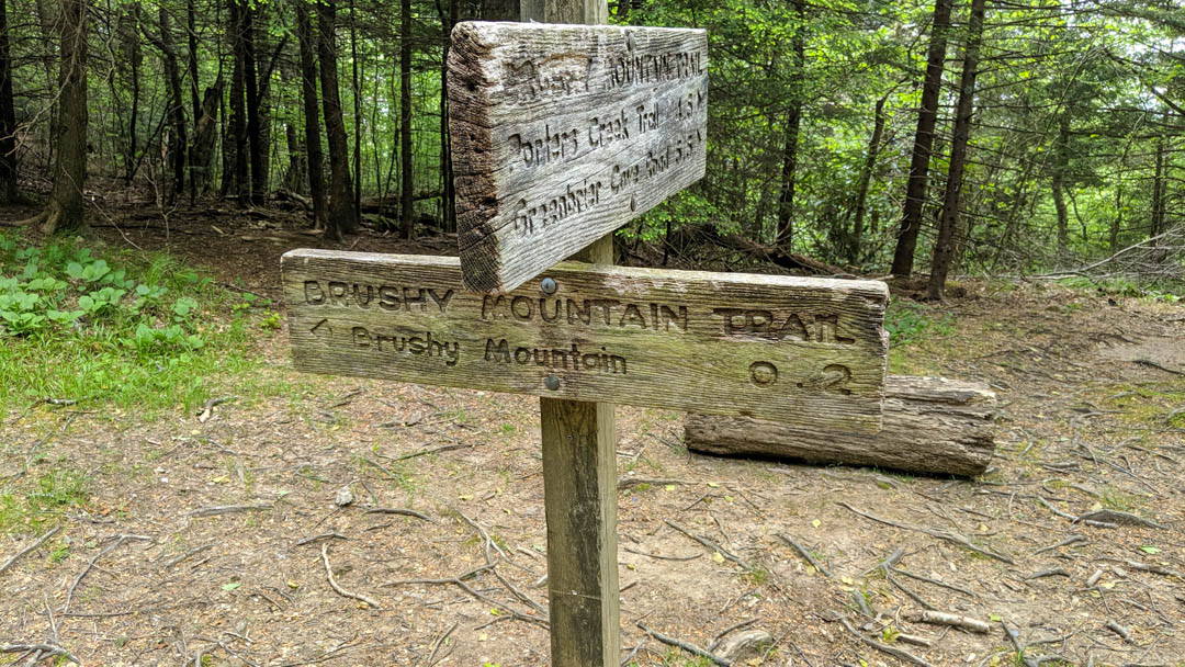
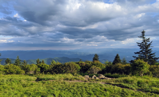
Full disclosure, I was not aware of Brushy Mountain prior to taking this hike. I simply knew I wanted to hike past Grotto Falls and see how far I could go. When I got to the trail juncture at Trillium Gap (for which the trail I just hiked is named), I saw a sign the pointed to Brushy Mountain (see below). Because of the short distance, I decided to give it a go. I was not disappointed. I never found a marker for the actual point, but after a short hike through a rhododendron tunnel (one of the most beautiful I've ever encountered), you will come out to a "clearing". I put that in quotes because the rhododendrons are still surrounding you, just not above your head and the views are wonderful.
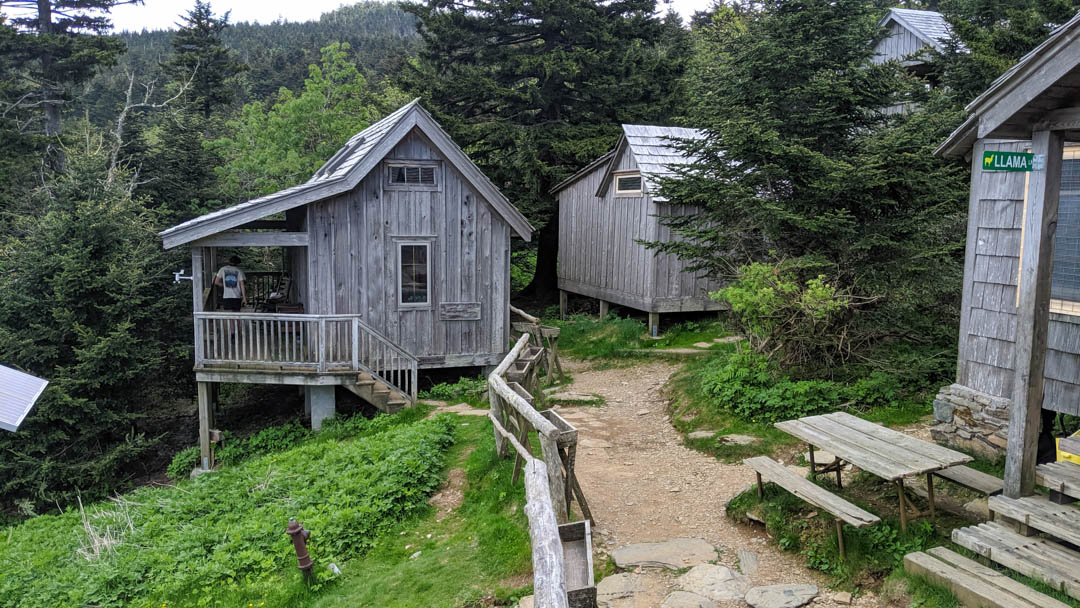
Once I made my way back to the trail juncture, it was time to make my way to the top. It was quite a haul and I was sweating most of the way, but thankfully it was cooling off as I continued to climb (even though I didn't really notice). Once near the top, the first thing you'll notice is the cabins. There are quite a few of them. I made my way to the lodge to see if there was access, and to my surprise, not only was I allowed in, but they had a deck on the back where I was able to relax for a bit and get out some snacks. When arriving at the lodge, I noticed that it was currently 68°. Yes, over 20° lower than the trailhead. As mentioned earlier, I didn't really notice the change as I was climbing, but I sure did notice the change on the way back down.
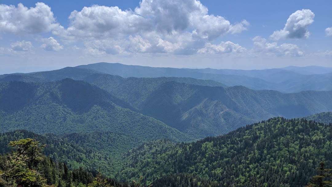
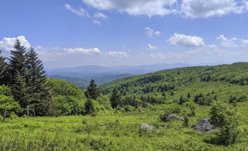
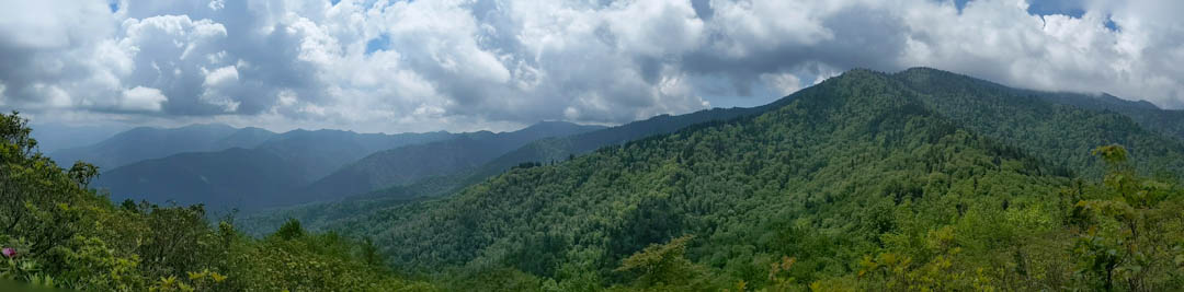
Finally at the top, and now being nourished and hydrated, I decided to take a look at different areas of Mount Le Conte. Obviously I wanted to stand on the peak, which I did. It's actually tree covered, so it was more of a photo op than a view point. An other area I visited is called Cliff Top. A nice little hike on a side trail and absolutely stunning views.
In total, I ended up hiking 15.6 miles on this hike. This included the 0.4 miles round trip to Brushy Mountain, and walking around to different areas up on Mount Le Conte. Without all that, I believe it is just under 14 miles, but believe me, the extra 1.5 (easy) miles is more than worth it. As for my rating of the hike, it is an absolutely beautiful area with many different views. The hike is long and grueling at times, but I'll still rate it 8.5/10. If it were the only trail to Mount Le Conte, I'd gladly do it again, but there are several other trails that lead to the top that I'd like to explore some day. I look forward to visiting and exploring Mount Le Conte again in the future.
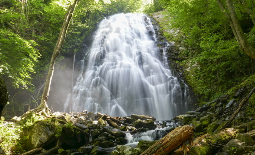
You may be wondering why there isn't a picture of Grotto Falls, this is primarily a waterfall site is it not? It is, but on this specific trip, it was so busy around the falls I didn't even try to take a good picture. The one I grabbed with my phone is quite pathetic. I suspect I'll be back in the area soon and will be sure to try and get a good picture of Grotto Falls.