Mount Rogers
| Trailhead Coordinates | 36.687564, -81.540280 |
| Feature Coordinates | 36.660052, -81.544900 |
| Feature Elevation | 5729 ft (1746 m) |
| Hike Distance | 20.3 mi (32.7 km) |
| Elevation Gain | 3535 ft (1077 m) |
| Rating (out of 10) | 8.5 |
This entry is a little different than most. First, it's a backpacking trip I took, not a day hike, and second, the "feature", Mount Rogers is not really exciting. While this peak is the highest in Virginia, it is completely under cover of the forest, so there is no scenic view to speak of. Don't let that discourage you though, there are many gorgeous views in the surrounding area. It is absolutely worth a visit.
Keep in mind that while the area is much better suited for backpacking, there are many routes that are quite suitable for day hikes.
When I planned this trip, my original idea was to hike for three days, but I ended up completing it in two. You could honestly spend a week in the area and possibly not hike all the trails. There are a lot and each has it's own "personality". I mention that because generally in an area with a lot of trails, many of them have the same feel. On this trip I felt like I was in 3 or 4 different areas at any given time. It really is an interesting place.
I started out at Grindstone Recreation Area Campground. There are many areas outside of the campground you can park, but there have been reports of breaking into cars in those places over the years. I'm not sure if it's really an issue to be concerned about, but being that I was on a week long trip and had quite a bit of gear being left in my car, I decided to play it safe by parking at the campground. They will charge you a nightly fee to park there, but the security was worth it for me. The only drawback for me was that with it being a holiday weekend, I was lucky to find a place to park.
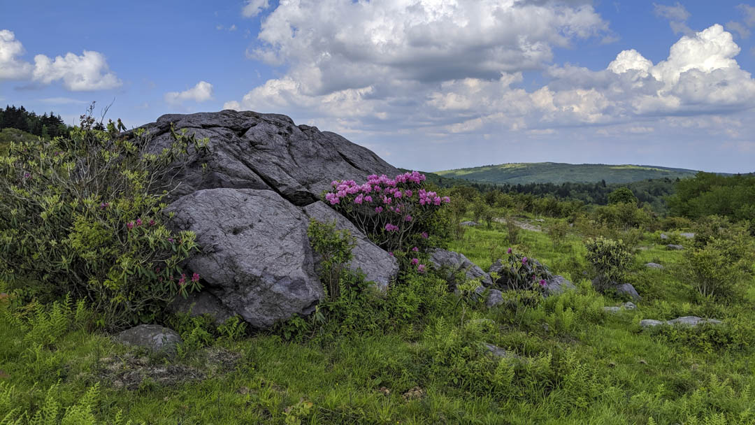
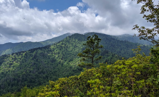
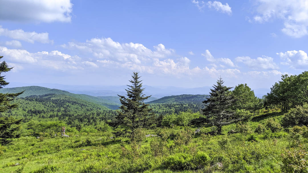
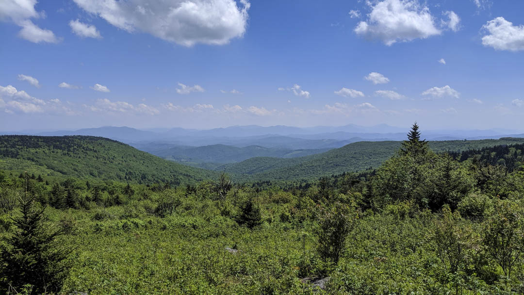
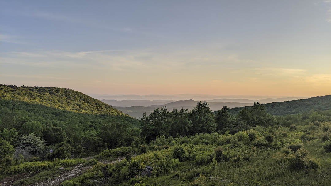
Day 1: Once loaded up and ready to hit the trail, I made my way to the trailhead about a 1/4 mile from where I parked. As I was just getting started, a family was on their way out and informed me they had just spotted a bear. That didn't stop me from moving on, but I was on high alert for the first couple of miles. It wasn't long before the climb from the campground was completed and I was up on Elk Ridge, and I soon passed a large scout troop heading the other direction. Any concern I had with seeing a bear at that point dissipated. The climb wasn't too bad as there were a couple switchbacks to ease the climb. Once on top, it was level for a little while and was easy hiking. Pretty soon though, things became a little more interesting as it was getting more rocky. It wasn't too long like this and I was making my way out of the woods to the incredible views of the Blue Ridge Mountains you get in Lewis Fork Wilderness.
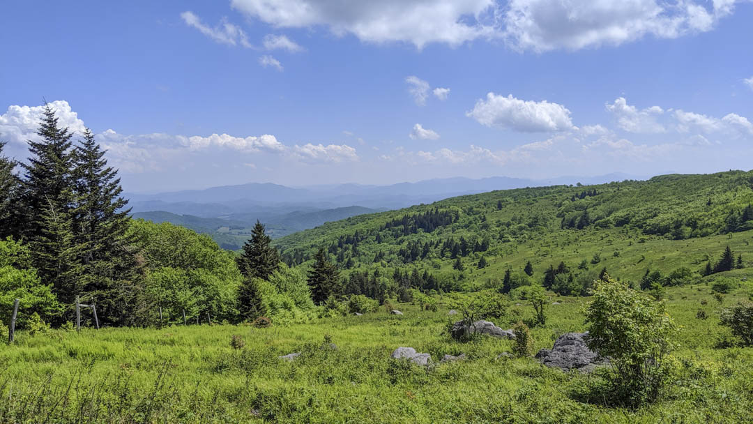
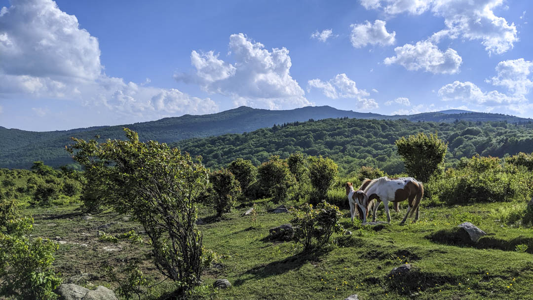
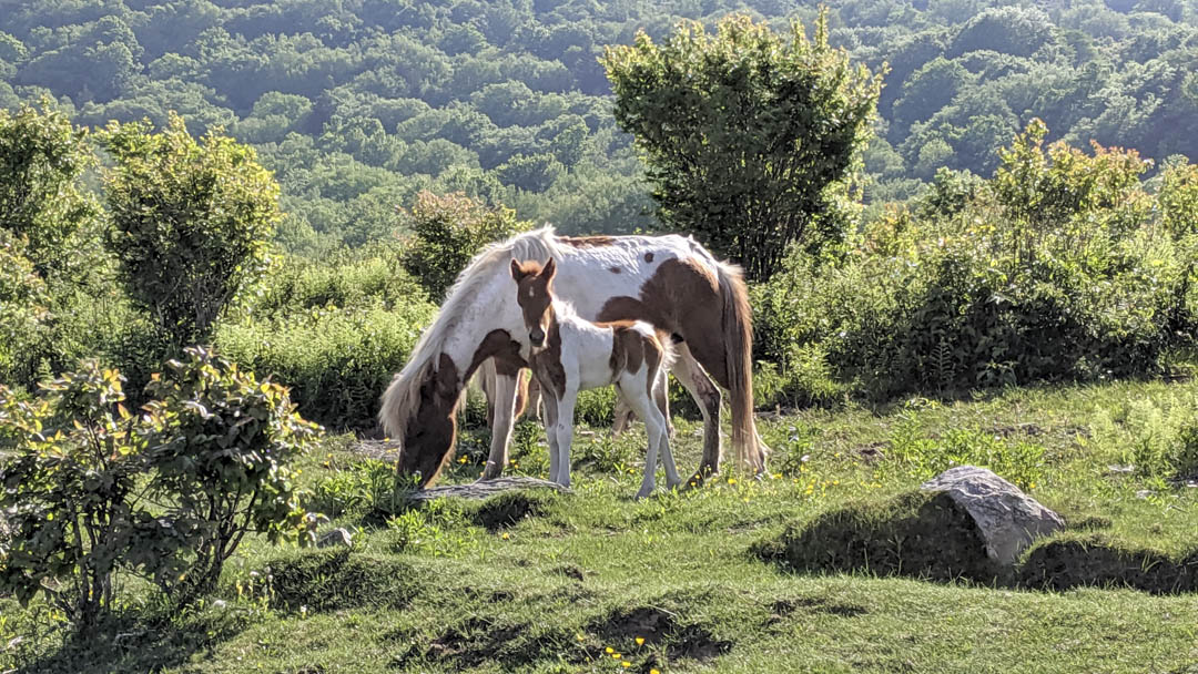
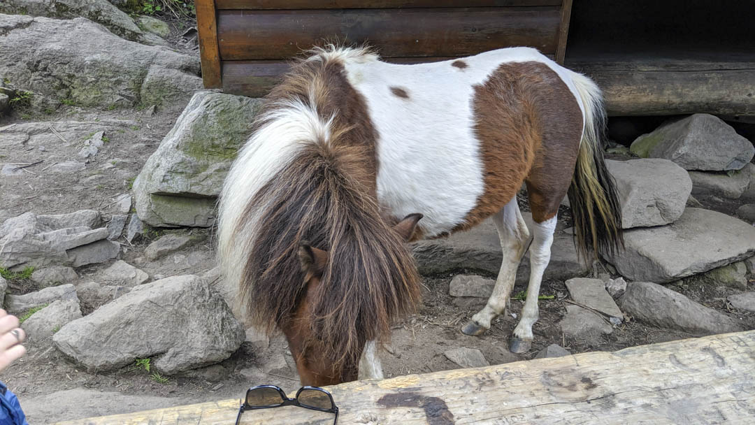
The views were absolutely stunning. I got my first glimpse of the wild ponies off in the distance, the sun was shining, and there was a pleasant breeze. I kept taking it in as I hiked, happy to finally have made this trip I had been wanting to take for a couple years. Eventually I found a nice rock to sit and take a break and eat my lunch while enjoying the expansive views.
After my break, it was time to summit Mount Rogers. I already knew that I was only going to say that I had been there, that there wasn't going to be a view, but I'm glad I did. Yes it is forested and you can't see anything from the summit, but it was part of the experience. Will I ever go back to the summit, maybe if I'm hiking with someone new who desires to go, but I can't imagine I will if alone again. Once done with that portion of the hike, it was on to Thomas Knob Shelter and possibly looking for a place to set up for the night.
As I was getting to the shelter, I had already started contemplating continuing on because it was still fairly early. Once I reached the shelter and the surrounding area, I knew for sure I was continuing on because it was very busy (did I mention it was Memorial Day weekend?), with people and ponies.
I really did like the area around Thomas Knob and if I ever find myself backpacking here again, I will be hopeful I can stay somewhere near the shelter. For one, it has those expansive views I've already shown you. It also has a spring for water, so there's no hiking a mile or two to the nearest creek to fill up, which is common when camping high. It would also be nice to have people you can sit around and chat with if hiking alone. On this trip though, there were just too many people, and probably would have been near impossible to find a comfortable spot to pitch my tent.
After making the decision to keep going, I knew that one option was my initially expected night 2 destination, Scales Campground. As I continued to hike and making good progress, I realized I had plenty of time to get there, but it was just a good amount of miles for day 1, especially since I did almost 16 miles and climbed over 4000 feet the previous day, and because I got a late start on this day due to having a 2.5 hour drive to the trailhead. The trail I was on through this section was basically an old road and the hiking was fairly easy as well. The only thing that slowed me down at one point was the cattle that graze in the area. Texas Longhorn cattle.
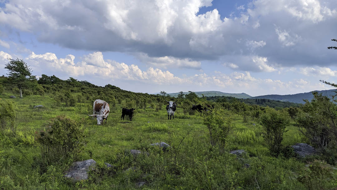
They weren't generally an issue as they were not on the trail and kept to themselves, but I did happen upon a group on young in the middle of the trail and as I approached, parents started coming out of the brush. I decided to keep my distance to see if they would move along. As I was waiting, I could hear the group on horseback I had passed 30 minutes prior. I decided to wait for them and walked in the middle of the pack until we were past the group of cattle. Uneventful really, but it did add some unexpected interest to my hike.
When I finally arrived at Scales, I was glad I pushed to get here. There were a few other places I could have stopped, but being alone on this trip, I liked the idea of being around other campers. Scales also had pit toilets and a water source. I don't believe the water is potable, so I filtered it to be on the safe side. Once I had my tent setup and my water bottles topped of, I made some dinner and decided to wander around some.
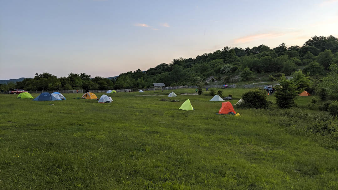
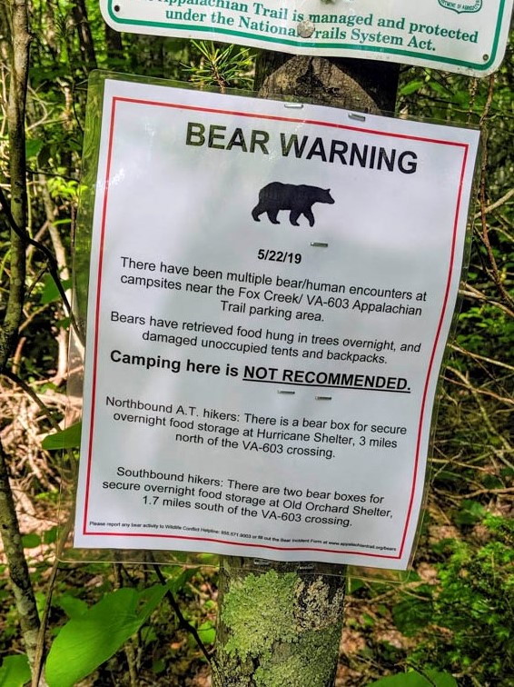
You can see in the picture, Scales is not your typical campground. There are no established site, and obviously no hookups of any sort. This is basically a large area enclosed by a fence to keep the ponies and cattle out. You can also see a couple vehicles in the picture, but it requires an off road capable vehicle to get here. Most of the occupants are going to be backpackers. It is a very beautiful setting, and it felt secure, especially with the knowledge there have been more bear encounters in recent days (there is a nearby shelter that was temporarily closed because of bear activity). I'm not afraid of bears because I take all usual precautions like not eating or storing food in my tent, and if possible, hanging a bear bag away from the tent, but having the added security provided me to be more at ease. The pit toilet was a welcome addition too. It's hard to call a pit toilet a luxury, but when you're backpacking, it sure is.
Day 2: As I sometimes do while backpacking, I woke around first light, well before sunrise. This gave me an opportunity to walk around in the peacefulness of the early morning and stretch my legs some before hitting the trail. What a delight I was greeted with as the sun started making it's way over the surrounding hills.
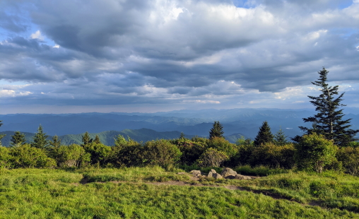
Since I put in almost 12 miles the previous day, I knew I had less than 10 to get back to my car, depending on the trails I took. With that in mind, I decided to go ahead and just finish today. Being up early, I knew I'd be back to my car by noon anyways, and would have enough time to drive all the way home. The hike out was pretty much a continuation from the previous day in that I seemed to cross into different areas frequently, from woods, to open grassy areas, to open rocky areas, to low brush, and then wrapping up along a river in the valley. The diversity of terrain in this area was very unexpected and it is something that will eventually draw me back.
Once I broke camp, it was an uphill climb for the firs couple of miles. I had about 400 feet I needed to gain to get the point where it was going to be mostly downhill the rest of the way. One of the things I remember most about the first few miles on day two is the number of gates I had to go through. Some were actually swinging gates, while others were simply fenced tight turns that cattle is not able to navigate. I had a number of gates to get through on day one as well, but I don't believe as many. Once I reached the high point at 2 miles, it was pretty much all downhill, at least to the road crossing. I had many trail options back to my car, and one that I took was called Cliffside Trail. I will say that it is appropriately named, it's q very steep descent. I believe I dropped nearly 700 feet in less than a mile. From there, I made my way back to the Appalachian Trail, which took me to the road crossing and another trail back to my car. I past a few different groups who were still lounging around for the morning. At the point I was leaving the AT to head back to my car, I saw this (which I mentioned earlier).
All in all, a great trip. I really enjoyed myself, more than I was expecting. When I started writing this, my initial thought was 8, but as I've now recounted my experience, I am bumping it up to 8.5. I fell in love with this area, and there's so much more for me to explore that I didn't get to see on this trip. In fact, now that I have a vehicle capable of getting to the Scales, I will most likely make a car camping trip out of it and put in some good day hikes. I very much look forward to that trip in the near future.
I generally save my pictures for the end of my post, but all of the above helped provide a visual of my experiences. There are more pictures to share than I had story to tell, and they can be found below as usual.